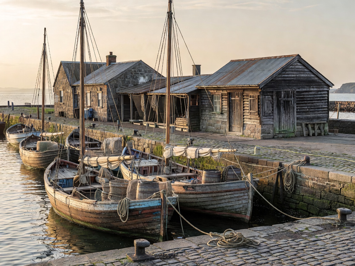
Historic harbours are layered working places. Their shape may reflect shelter, navigation, landing, storage and repair. A pier or quay is not merely a picturesque edge; it is a connection between water and the systems on land.
Read the harbor plan
Begin with the entrance and the sheltered water behind it. Natural coves, islands and headlands can reduce exposure. Built defenses may add protection where natural shelter is limited. The arrangement varies: a harbor can use a projecting pier, a protected basin, a simple landing edge or several small access points. Avoid assuming that one visible structure explains the full history or purpose of a place.
Look at how boats approach and where they can lie. The harbor’s turning space, water depth and channel access are operational matters, even when they are not obvious from shore. Avoid walking on working surfaces unless access is clearly public. Keep clear of mooring lines, ramps, vehicles and equipment.
Piers, quays and landing edges
A pier projects into water and can provide access on one or more sides. A quay is generally a more continuous edge beside water, often used for berthing, loading or movement along the shore. Local usage and design differ, so treat these words as helpful descriptions rather than a complete classification.
Materials and details provide clues. Stone, timber, concrete and metal can coexist in one waterfront because repairs and extensions respond to use over time. Steps, ladders, bollards, rings and ramps serve practical purposes. Their presence does not mean a surface is safe or open to visitors. Wet stone and timber can be slippery. Tides, swell and ice may change conditions.
Boat storage and supporting buildings
Harbor work continues beyond the waterline. Storage buildings may hold nets, lines, tools or small craft. Sheds close to a landing place reduce handling distance. Larger or more sheltered structures can support maintenance and winter protection. Their location often makes sense when read beside access routes and the water’s edge.
Not every old building retains its first use. Some become workshops, stores or private spaces. A building’s current purpose should not be inferred from appearance alone. Observe from public paths and leave doors, gear and work areas untouched.
The working waterfront today
Many harbors balance multiple users. Fishing vessels, service craft, leisure boats, residents and visitors may share limited space. Commercial activity can change through the year. A quiet-looking quay may still be needed for a vessel or delivery later. A working harbor is not an open-air exhibit.
Access rules, safety notices and barriers take priority. Do not block vehicle routes or boat movement for photographs. Avoid stepping over lines or standing under suspended loads. Keep children close to a responsible adult near water and machinery. Follow instructions from staff or local signs.
Maritime heritage and preservation
Preserving a harbor involves more than keeping old masonry. It can include maintaining access to water, retaining useful working structures and managing changes without erasing evidence of earlier use. Repair choices need to account for salt, water, freeze-thaw cycles, movement and the demands of present-day operation.
Some changes are necessary for safety or continued use. New materials and equipment may sit beside older structures. The result can still retain heritage value if the relationships remain legible. Preservation decisions are local and technical. This guide does not assess individual sites or provide conservation advice.
Regional comparisons
On a fjord coast, steep slopes and narrow water corridors can concentrate harbor activity. In island and archipelago settings, multiple sheltered channels may connect small landing places. On more exposed coasts, breakwaters or other protection can define the working edge. Baltic shores, North Atlantic islands and mainland fjords differ in water conditions, materials, access and local practice.
Compare the site’s actual geography rather than relying on a broad regional stereotype. Ask what the harbor needs to protect, which routes it serves and how buildings support boats. These questions reveal more than a decorative label.
Field checklist
- Identify public paths, operational areas and posted restrictions.
- Observe how the entrance, shelter and landing edge relate.
- Look for links between quay, storage, repair and road access.
- Note changes in materials without assigning unsupported dates.
- Keep clear of vessels, ropes, machinery and loading activity.
Good for
Readers interested in maritime infrastructure, harbor history, working landscapes and how small-scale coastal access is organized.
What to know
Harbor access, safety conditions and work schedules can change. Confirm current visitor access with the relevant local or official provider. A public-looking quay may still have operational restrictions.
Advantages and constraints
What the harbor reveals
- Clear links between water access and village layout.
- Visible evidence of repair, shelter and adaptation.
- Multiple layers of maritime use.
What limits observation
- Working operations can restrict access without notice.
- Water edges can be slippery and exposed.
- Changes in materials rarely establish a precise date by themselves.
Observe from public ground. Give working space, equipment and moored vessels a wide clearance.
Related guides
Next guide / Building fabric